Library
Our library features many hundreds of entries.
To search among them, click "Search" below to pull down options, including filtering by document type, author, year, and keyword.
Find these options under "Show only items where." Or you can also sort by author, title, type, and year clicking the headings below.
1994. Implementation Manual for the San Leandro Creek Watershed Awareness Program, 1993-1994. SFEI Contribution No. 177. San Francisco Estuary Institute: Richmond, Ca. p 75.
1999. Impacts of Nonindigenous Species on Subtidal Benthic Assemblages in the San Francisco Estuary. SFEI Contribution No. 329. p 16.
1994. Impacts of invasions in the Bay and Delta. Abs. Proc. 75th Ann. Mtg., Pac. Div. Amer. Assoc. Adv. Sci..
2001. Impacts from the Asian clam Potamocorbula amurensis. In National Management Plan. National Management Plan. National Invasive Species Council: Washington DC.
2005. Impact of invasive Spartina alterniflora on song sparrow and marsh wren populations in San Francisco Bay salt marshes. Proceedings of the International Spartina Conference.
2002. The impact of an invasive Atlantic cordgrass (Spartina alterniflora) on San Francisco Bay Song Sparrow populations: direct and indirect influence. In Terrestrial Vertebrates of Tidal Marshes: Evolution, Ecology and Conservation. Terrestrial Vertebrates of Tidal Marshes: Evolution, Ecology and Conservation. Silver Spring, MD.
2002. Identification and evaluation of unidentified organic contaminants in the San Francisco Estuary. SFEI Contribution No. 45. San Francisco Estuary Institute: Oakland, CA.
2003. Identification and evaluation of previously unknown organic contaminants in the San Francisco Estuary (1999-2001). SFEI Contribution No. 75. San Francisco Estuary Institute: Oakland, CA.
2006. Identification and emission factors of molecular tracers in organic aerosols from biomass burning: Part 3. Grasses. Applied Geochemistry 21 (6) . SFEI Contribution No. 491.
2021. Hydrodynamic, sediment transport, and sediment flocculation data from south San Francisco Bay, California, summer 2020. United Sates Geological Survey.
The U.S. Geological Survey (USGS) Pacific Coastal and Marine Science Center collected hydrodynamic and suspended sediment flocculation data at channel and shallow water sites in south San Francisco Bay in July 2020. The data were used to determine water column stratification, turbulence profiles, and floc size evolution. The goal of this project was to bound the controls on floc size and floc settling velocity to improve estimates of sediment fluxes and consider error in numerical models of sediment transport in San Francisco Bay. This data release includes hydrodynamic, sediment concentration, and particle size timeseries during July 2020, as well as sediment bed properties, water column particle size distributions, and CTD profiles collected on four days in July 2020 at both sites. Details on station location, instrumentation, and measured variables are included on pages for each data type. These data were collected as part of a collaborative project with the USGS California Water Science Center. Funding was provided by the San Francisco Estuary Institute.
2019. Hydrodynamic Model Development Report: Sacramento-San Joaquin River Delta and Suisun Bay (Water Year 2016). SFEI Contribution No. 964. San Francisco Estuary Institute: Richmond, CA.
2018. Hydrodynamic and Water Quality Model Calibration and Application in San Francisco Bay. SFEI Contribution No. 913. San Francisco Estuary Institute : Richmond, CA.
2023. Hydrodynamic and sediment transport data from Whale's Tail marsh and adjacent waters in South San Francisco Bay, California 2021-2022. United States Geological Survey.
The U.S. Geological Survey Pacific Coastal and Marine Science Center collected hydrodynamic and sediment-transport data at shallow water sites in South San Francisco Bay and in the Whale's Tail South marsh in Eden Landing Ecological Reserve in Alameda County, CA in 2021 and 2022. This data release includes hydrodynamic and sediment transport time-series data spanning from June 2021 to January 2022, as well as sediment bed properties and water column suspended-sediment concentrations Details on station location, instrumentation, and measured variables are included in sections for each data type. The data were collected to determine sediment supply and sediment delivery to marshes, both in the bay and in tidal creeks as well as across the bay-marsh interface during varying tidal and wave conditions. The goal of the project was to more accurately predict the fate of marshes and to optimize management actions. They were collected as part of a collaborative study with the USGS Western Ecological Research Center. These data are intended for science researchers, students, policy makers, and the general public.
2005. Human influences on nitrogen and phosphorus concentrations in creek and river waters of the Napa and Sonoma watersheds, northern San Francisco Bay, California. SFEI Contribution No. 421. San Francisco Estuary Institute: Oakland.
2021. On the human appropriation of wetland primary production. Science of the Total Environment 785.
 Humans are changing the Earth's surface at an accelerating pace, with significant consequences for ecosystems and their biodiversity. Landscape transformation has far-reaching implications including reduced net primary production (NPP) available to support ecosystems, reduced energy supplies to consumers, and disruption of ecosystem services such as carbon storage. Anthropogenic activities have reduced global NPP available to terrestrial ecosystems by nearly 25%, but the loss of NPP from wetland ecosystems is unknown. We used a simple approach to estimate aquatic NPP from measured habitat areas and habitat-specific areal productivity in the largest wetland complex on the USA west coast, comparing historical and modern landscapes and a scenario of wetland restoration. Results show that a 77% loss of wetland habitats (primarily marshes) has reduced ecosystem NPP by 94%, C (energy) flow to herbivores by 89%, and detritus production by 94%. Our results also show that attainment of habitat restoration goals could recover 12% of lost NPP and measurably increase carbon flow to consumers, including at-risk species and their food resources. This case study illustrates how a simple approach for quantifying the loss of NPP from measured habitat losses can guide wetland conservation plans by establishing historical baselines, projecting functional outcomes of different restoration scenarios, and establishing performance metrics to gauge success.
2014. How Creeks Meet the Bay: Changing Interfaces (Interactive web map).
San Francisco Bay’s connections to local creeks are integral to its health. These fluvial-tidal (F-T) interfaces are the points of delivery for freshwater, sediment, contaminants, and nutrients. The ways in which the F-T interface has changed affect flooding dynamics, ecosystem functioning, and resilience to a changing climate. As the historical baylands have been altered, the majority of contemporary F-T interface types have changed leading to additional F-T interface types within the present-day landscape. Illustrations of each F-T interface type and methods for classification are available here.
This project is part of Flood Control 2.0. For further information please visit this project page.
2021. Holistic Assessment of Microplastics and Other Anthropogenic Microdebris in an Urban Bay Sheds Light on Their Sources and Fate. Environmental Science and Technology Water . SFEI Contribution No. 1060.

The physical and chemical properties of microplastics and their environmental distributions may provide clues about their sources and inform their fate. We demonstrate the value of extensive monitoring of microplastics in an urban bay, San Francisco Bay. Surface water, fish, sediment, stormwater runoff, and treated wastewater were sampled across the bay and adjacent national marine sanctuaries (NMS). We found microplastics and other anthropogenic microdebris (“microdebris”) in all sample types. Concentrations were higher in the bay than in the NMS, and within the bay, concentrations were higher during the wet season than during the dry season. The fate of microdebris varied depending on their morphologies and densities: fibers were dominant in fish, black rubbery fragments were common in sediment, as were fibers, while buoyant fragments and fibers were widely observed in surface waters. Notably, we found large amounts of black rubbery fragments, an emerging contaminant, in stormwater. Moreover, stormwater was a significant pathway of microdebris, with concentrations roughly 140 times greater than those found in wastewater, which was dominated by fibers. Overall, we demonstrate the value of multimatrix regional monitoring to evaluate the sources and fate of microplastics, which can inform effective mitigation for other urban bays around the world.
2011. Historical Wetlands of the Southern California Coast: An Atlas of US Coast Survey T-sheets, 1851-1889. SFEI Contribution No. 586. SFEI: Oakland.
2010. Historical Vegetation and Drainage Patterns of Western Santa Clara Valley: A technical memorandum describing landscape ecology in Lower Peninsula, West Valley, and Guadalupe Watershed Management Areas. SFEI Contribution No. 622. SFEI: Oakland.
2007. Historical landscape ecology of an urbanized California valley: wetlands and woodlands in the Santa Clara Valley. Landscape Ecology 103-120.
2005. Historical Landscape Analysis (full title to come from Robin). SFEI Contribution No. 396. San Francisco Estuary Institute.
2002. The Historical Geography and Biogeography of Tidal Salt Marshes (Abstract). San Francisco Estuary Institute.
1995. Historical Evidence of Freshwater Effects on the Plan Form of Tidal Marshlands in the Golden Gate Estuary, University of California: Santa Cruz, p 130 pp.
2009. Historical Ecology Reconnaissance for the Lower Salinas River. SFEI Contribution No. 581. San Francisco Estuary Institute: Richmond. p 32.
2018. The Historical Ecology of the Tijuana Estuary & River Valley (Restore America's Estuaries 2018 Conference Presentation).
This talk was given at the 2018 Restore America's Estuary Conference in Long Beach, CA as part of a special session titled "Restoration Perspectives from the Tijuana River National Estuarine Research Reserve." It is based on information from the Tijuana River Valley Historical Ecology Investigation, a report published in 2017.
Though many areas of the binational Tijuana River watershed remain relatively undeveloped, land and water use changes over the past 200 years have resulted in significant ecological impacts, particularly in the more urbanized areas of the lower watershed. Drawing upon a diverse set of historical data, we reconstructed the ecological and hydrogeomorphic conditions of the lower Tijuana River valley prior to major Euro-American modification (ca. 1850) and documented major changes in habitat distribution and physical processes over this time. The river corridor, which was historically dominated by riparian scrub, today instead supports dense stands of riparian forest. The valley bottom surrounding the river corridor, which historically supported extensive seasonal wetlands, has largely been converted to drier habitat types and agricultural uses. The estuary, which historically supported large expanses of salt marsh and mudflat as well as seasonally dry salt flats, has retained much of its former extent and character, but has been altered by increased sediment input and other factors. The new information about the historical landscape presented here is relevant to a number of issues scientists and managers are dealing with today, including the conservation of endangered species, the fate of the valley’s riparian habitats after the recent invasion of invasive shot-hole borer beetles, and the effects on groundwater levels on native plant communities. We will also draw from other historical ecology studies conducted in Southern California to illustrate how the information about the past has been utilized to improve the functioning and resilience of nearby coastal ecosystems.
Presentation recording: available here.
. 2012. Historical Ecology of the McCormack-Williamson Tract: A Landscape Framework for Restoration. SFEI Contribution No. 674. Aquatic Science Center / San Francisco Estuary: Richmond, CA.
2011. Historical Ecology of the lower Santa Clara River, Ventura River, and Oxnard Plain: an analysis of terrestrial, riverine, and coastal habitats. SFEI Contribution No. 641. SFEI: Oakland.
2009. Historical Ecology of the California Delta: Emerging Concepts of a Complex and Dynamic System.
2007. Historical Ecology of South Santa Clara County: Preliminary Findings. A Technical Memorandum to the Santa Clara Valley Habitat Conservation Plan/Natural Community Conservation Plan. SFEI Contribution No. 527.
2008. The Historical Ecology of Napa Valley: An Introduction. SFEI Contribution No. 557.
2009. Historical Ecology of Lower San Francisquito Creek Phase 1. San Francisco Estuary Institute: Oakland, Ca.
2012. Historical Ecology and Landscape-Scale Restoration. Application to the McCormack-Williamson Tract.
2017. Historical Ecology and Landscape Change in the Central Laguna de Santa Rosa. SFEI Contribution No. 820. San Francisco Estuary Institute - Aquatic Science Center: Richmond, CA.
This study synthesizes a diverse array of data to examine the ecological patterns, ecosystem functions, and hydrology that characterized a central portion of the Laguna de Santa Rosa during the mid-19th century, and to analyze landscape changes over the past 150 years. The primary purpose of this study was to help guide restoration actions and other measures aimed at reducing nutrient loads within this portion of the Laguna de Santa Rosa watershed.
2014. Historical Changes in Channel Alignment along Lower Laguna de Santa Rosa and Mark West Creek. SFEI: Richmond, CA.
2002. The highly invaded ecosystem of San Francisco Bay. Cawthron Institute, Nelson, New Zealand.
1994. The hidden costs of California's water. In Life on the Edge: A Resource Guide to California's Endangered Wildlife. Life on the Edge: A Resource Guide to California's Endangered Wildlife. Biosystems Books: Santa Cruz, CA. pp 288-302.
2008. Hg L 3 XANES study of mercury methylation in shredded Eichhornia crassipes. Environmental Science and Technology.
2005. Hg Fate and Transport Within the San Jose/Santa Clara WPCP: Study Design and Preliminary Results.
1997. Have claw, will travel. Aquatic Nuisance Species Digest 2, 1, 16-17. . SFEI Contribution No. 200.
2016. Hacienda Avenue Bio-Infiltration Basins (Case Study - Fact Sheet). San Francisco Estuary Institute: Richmond, CA.
2010. Habitat-Related Benthic Macrofaunal Assemblages of Bays and Estuaries of the Western United States. Integrated Environmental Assessment and Management 8 (4), 638-648.
2018. Gut Contents Analysis of Four Fish Species Collected in the San Leandro Bay RMP PCB Study in August 2016. SFEI Contribution No. 900. San Francisco Estuary Institute: Richmond, CA.
2021. Guidance for Restoration of Natural and Nature-Based Features in the Wetland-Upland Transition Zone. San Francisco Estuary Institute, California State Coastal Conservancy: Richmond, CA.
2010. Guidance for Potential Removal of Creosote-Treated Pilings and Structures in San Francisco Bay.
2009. Guadalupe Watershed Model Year 1 Report. Oakland, CA.
2009. Guadalupe Watershed Model.
2008. Guadalupe Watershed Model.
2011. Guadalupe River Watershed Loading HSPF Model: Year 3 final progress report. SFEI: Richmond, CA.
2018. Guadalupe River Mercury Concentrations and Loads During the Large Rare January 2017 Storm. SFEI Contribution No. 837. San Francisco Estuary Institute : Richmond, CA.
2023. Growing Resilience: Recommendations for Dune Management at North Ocean Beach. SFEI Contribution No. 1155. San Francisco Estuary Institute: Richmond, CA.
2002. Groundwater seepage into northern San Francisco Bay: implications for dissolved metals budgets. Wate Resources Research . SFEI Contribution No. 54.
2021. Green Stormwater Infrastructure Planning-level Analysis for Livermore-Amador Valley. SFEI Contribution No. 1063. San Francisco Estuary Institute: Richmond, Calif.
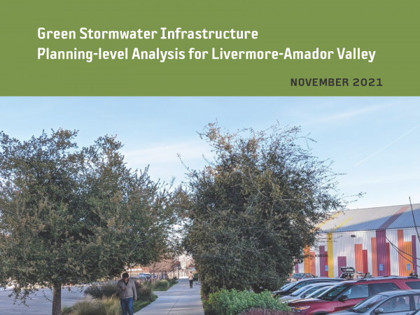 This effort is intended to provide planning-level regional guidance for placement of green stormwater infrastructure (GSI) in Livermore-Amador Valley. This work identifies potential GSI locations and quantifies contaminant load and stormwater runoff volume reduction benefits through the application of GreenPlan-IT, a planning tool developed by the San Francisco Estuary Institute and regional partners. Ultimately, the urban greening analysis presented in this report is intended to help enhance stream and watershed resilience, reduce peak flows, and improve water quality.
2018. GreenPlan-IT Tracker.
This technical memo describes the purpose, functions, and structure associated with the newest addition to the GreenPlan-IT Toolset, the GreenPlan-IT Tracker. It also shares the opportunities for further enhancement and how the tool can operate in concert with existing resources. Furthermore, this memo describes a licensing plan that would permit municipalities to use the tool in an ongoing way that scales to their needs. The memo concludes with a provisional roadmap for the development of future features and technical details describing the tool’s platform and data structures.
2015. GreenPlan-IT Toolkit User Guide. SFEI Contribution No. 958. San Francisco Estuary Institute: Richmond, CA.
Structurally, the GreenPlan-IT is comprised of three components: (a) a GIS-based Site Locator Tool to identify potential GI sites; (b) a Modeling Tool that quantifies anticipated watershed-scale runoff and pollutant load reduction from GI sites; and (c) an Optimization Tool that uses a cost-benefit analysis to identify the best combinations of GI types and number of sites within a watershed for achieving flow and/or load reduction goals. The three tool components were designed as standalone modules to provide flexibility and their interaction is either through data exchange, or serving as a subroutine to another tool. This user manual addresses each of the tools separately, though they are designed to complement each other.
2015. GreenPlan-IT Toolkit Demonstration Report. SFEI Contribution No. 958. San Francisco Estuary Institute: Richmond, CA.
GreenPlan-IT is a planning level tool that was developed by SFEP and SFEI with support and oversight from BASMAA to provide Bay Area municipalities with the ability to evaluate multiple management alternatives using green infrastructure for addressing stormwater issues in urban watersheds. GreenPlan-IT combines sound science and engineering principles with GIS analysis and optimization techniques to support the cost-effective selection and placement of Green Infrastructure (GI) at a watershed scale. Tool outputs can be used to develop quantitatively-derived watershed master plans to guide future GI implementation for improving water quality in the San Francisco Bay and its tributary watersheds.
This report provides an overview of the GreenPlan-IT Tool and demonstrates its utility and power through two pilot studies which is summarized in this report as a case study. The pilot studies with the City of San Mateo and the City of San Jose explored the use of GreenPlan-IT for identifying feasible and optimal GI locations for mitigation of stormwater runoff. They are provided here to give the reader an overview of the user application process from start to finish, including problem formulation, data collection, GIS analysis, establishing a baseline condition, GI representation, and the optimization process. Through the pilot study application process the general steps and recommendations for how GreenPlan-IT can be applied and interpreted are presented.
2018. Green Plan-IT Application Report for the East Bay Corridors Initiative. SFEI Contribution No. 887. San Francisco Estuary Institute: Richmond, CA.
2018. Green Infrastructure Planning for the City of Sunnyvale with GreenPlan-IT. SFEI Contribution No. 881. San Francisco Estuary Institute : Richmond, CA.
2018. Green Infrastructure Planning for the City of Richmond with GreenPlan-IT. SFEI Contribution No. 883. San Francisco Estuary Institute: Richmond, CA.
2018. Green Infrastructure Planning for the City of Oakland with GreenPlan-IT. SFEI Contribution No. 884. San Francisco Estuary Institute : Richmond, CA.
2018. Green Infrastructure Planning for North Richmond Pump Station Watershed with GreenPlan-IT. SFEI Contribution No. 882. San Francisco Estuary Institute: Richmond, CA.
. 2016. Green Infrastructure at SFEI: Making Green Infrastructure Work in the Bay Area (Fact Sheet). San Francisco Estuary Institute: Richmond, CA.
1997. Green crabs disrupting fisheries worldwide. p 7 . SFEI Contribution No. 199.
1997. The Great Dun Fell Cloud Experiment 1993: An Overview. Atmospheric Environment 31 (16), 2393-2405.
. 2010. Grassland Bypass Project Report 2006-2007. San Francisco Estuary Institute: Oakland.