Sam Safran

Sam Safran
Consulting Ecologist
Resilient Landscapes Program
Delta Science & Management
Urban Nature Lab
(510) 746-7383
Sam joined SFEI's Resilient Landscapes program in 2012. His work focuses on understanding how ecosystems functioned in the past and how best to use this knowledge to inform present-day landscape-scale restoration and management. Along the way he relies heavily on geospatial analysis and landscape ecology. He also enjoys cartography and other forms of data visualization. Sam received his joint B.A. in Biology and Environmental Studies from Middlebury College in Vermont.
Related Projects, News, and Events
 Understanding Change in Primary Production at a Landscape Scale in the Delta (Project)
Constraints on primary production and the relative importance of different production sources to the food web remain major uncertainties in the Delta ecosystem. Newly available spatial data developed as part of the Delta Historical Ecology and Delta Landscapes projects make it possible to explore the effects of landscape configuration and hydrodynamics on primary production in a way that was not previously possible. Proposed order-of-magnitude calculations estimating primary production can ‘bookend’ the potential magnitude of production in the Delta, and inform what is possible in terms of restoration and management options.
 Mission Bay Historical Ecology Reconnaissance Study (Project)
The Mission Bay Historical Ecology Reconnaissance Study, completed in February of 2016, collected and organized data on the historical conditions of Mission Bay in San Diego County. The project was carried out in support of San Diego Audubon Society's ReWild Mission Bay project, a three-year planning effort exploring options to restoring wetlands in the northeast corner of the estuary.
 Delta Salmon Rearing (Project)
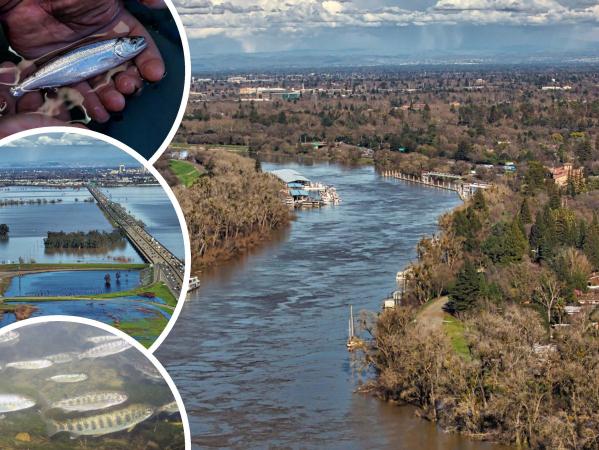
The objective of this project is to summarize existing research and knowledge around suitable rearing habitat for Chinook salmon in the Sacramento-San Joaquin Delta; identify areas of suitability for rearing salmon using a combined suitability analysis of four mapped habitat parameters; and to provide recommendations for types of restoration needed to improve or restore rearing habitat, as well as to identify where in the Delta these restoration efforts could be prioritized.
 Delta Landscapes Project (Project)
The Delta Landscapes Project, which began in 2012 and will run through 2016, has developed a body of work to inform landscape-scale restoration of the Sacramento-San Joaquin Delta ecosystem.
The San Francisco Estuary Partnership (SFEP) brings together the estuarine community every two years at the State of the Estuary Conference and, periodically, SFEP also reports on the State of the Estuary, summarizing the latest scientific findings about ecosystem health. This State of the Estuary Report is the only place where a holistic view of ecosystem function is provided across both the Bay and the Delta. This year, SFEI provided scientific leadership and technical support for the report, which focuses on the ties between social and ecological resilience for our estuary.
 The Adaptation Atlas, a new report by SFEI and SPUR, featured in the SF Chronicle and SJ Mercury News (News)
On May 2, 2019, the San Francisco Chronicle and San Jose Mercury News described how the Adaptation Atlas offers an innovative map of the Bay Area to promote nature-based strategies that can better assist our region in adapting to sea-level rise.
 A multi-partner project to create placed-based sea-level rise adaptation strategies (News)
As sea level rise accelerates in the San Francisco Bay, scientists, planners, and decision makers will need to re-envision and adapt our complex shoreline to provide ecological and social resilience. Although there are many efforts currently underway in the region to assess climate change vulnerabilities, the region lacks a coherent science-based framework for guiding and evaluating climate adaptation strategies appropriate to our diverse shoreline settings.
 Announcing SFEI's first binational study: The Tijuana River Valley Historical Ecology Investigation (News)
A new report shows how the Tijuana River Valley, which straddles the boundary between Southern California and northern Mexico, looked and functioned prior to the existence of the border wall, the city of Tijuana, and the state of California.
 Tijuana River Valley Historical Ecology Investigation Published (News)
The Tijuana River Valley Historical Ecology Investigation—completed in January 2017—synthesized hundreds of historical maps, photographs, and texts to reconstruct the ecological, hydrological, and geomorphic conditions of the Tijuana River valley prior to major European-American landscape modification.
 How to “ReWild” San Diego’s Mission Bay (News)
SFEI's Resilient Landscape Program recently completed a "reconnaissance" historical ecology study of San Diego's Mission Bay. This targeted project collected high-priority historical data (such as maps, photographs, and texts) that shed light on how Mission Bay and the surrounding region looked and functioned prior to major landscape modification during the 19th and 20th centuries.
 Lower Novato Creek Vision Just Released! (News)
SFEI recently released a resilient landscape vision for lower Novato Creek that incorporates habitat restoration actions into flood risk management. The vision, developed in coordination with a team of regional science experts, highlights opportunities for restoring and sustaining vital tidal wetland habitats around lower Novato Creek while supporting a high level of flood protection under rising San Francisco Bay water levels.
 EcoAtlas: New Map Enhancements (News)
The latest release of EcoAtlas (v4.1) includes two new map enhancements:
- ‹ previous
- 2 of 2