EcoAtlas: Bay Area Past & Present Map Info
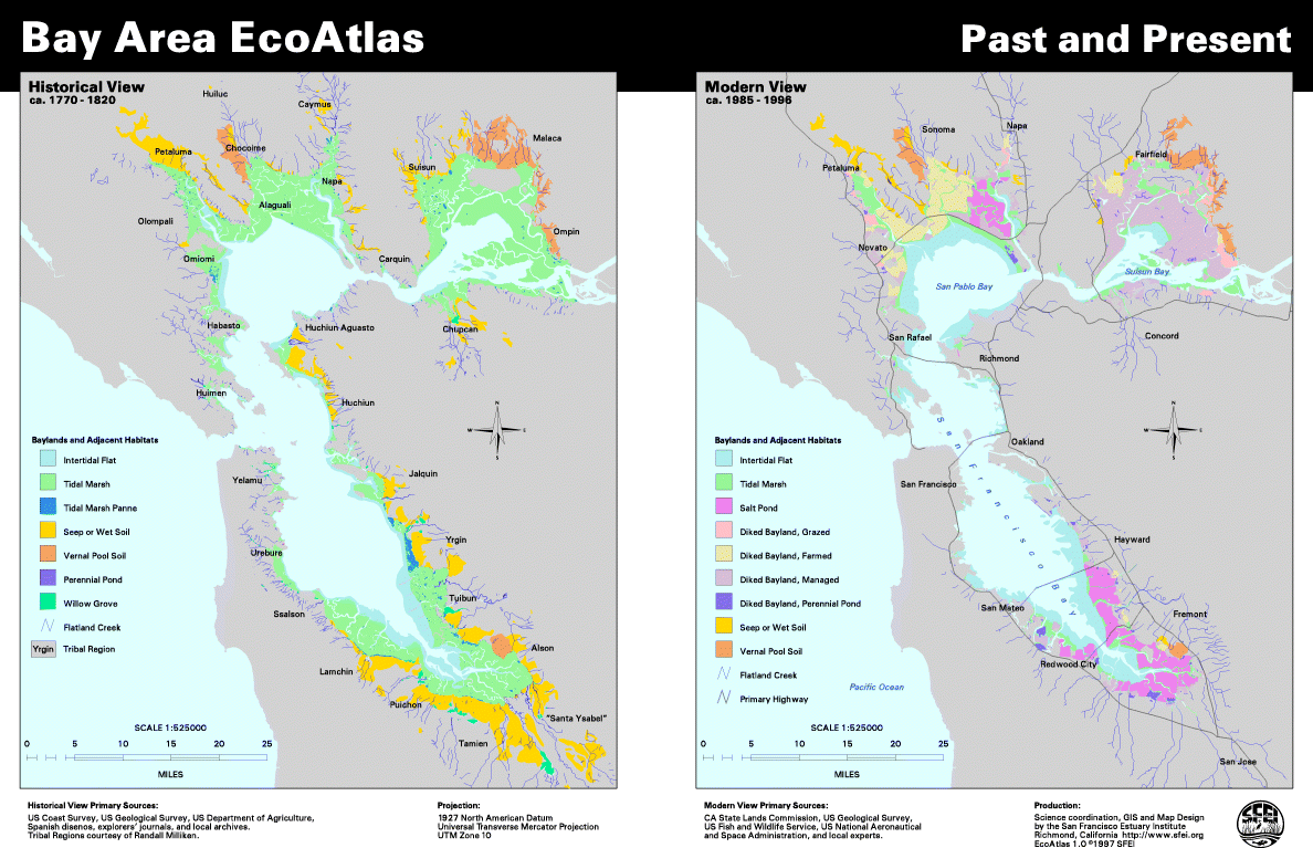
This map, produced from the Bay Area EcoAtlas, Version 1.0, for the State of the Estuary 1992 - 1997 Report, shows the distribution of major bayland and adjacent land habitat types in the San Francisco region circa 1770 - 1820 and 1985 - 1996. The Poster also shows the locations of native tribal regions around the Estuary, based on research by Randy Milliken.
Version 1.0 of the EcoAtlas represents the most detailed compilation of the historical and modern distribution of these habitats to-date. However, it is rapidly being updated to version 1.50. Version 1.50 will show significantly more habitat types, account for changes since 1985, and incorporate substantial local review. Version 1.0 is a draft product and should not be used for policy, planning, or scientific interpretation.
To obtain a copy of
the State of the Estuary Report, please contact Debbi Egter Van Wissekerke at the San Francisco Estuary Project, 510-622-2304.
Fur further information on Milliken's research, see his book,
A Time of Little Choice (Balleena Press, 1995).
Download full-size Bay Area Past and Present map in PDF format